Geopro regularly establishes permanent airport geodetic control (Primary and Secondary Airport Control Stations). This type of work is both very specialized and physically demanding! A typical project takes about six months to complete and requires coordination with the Airport, Consulting Engineers, the NGS, and the FAA.
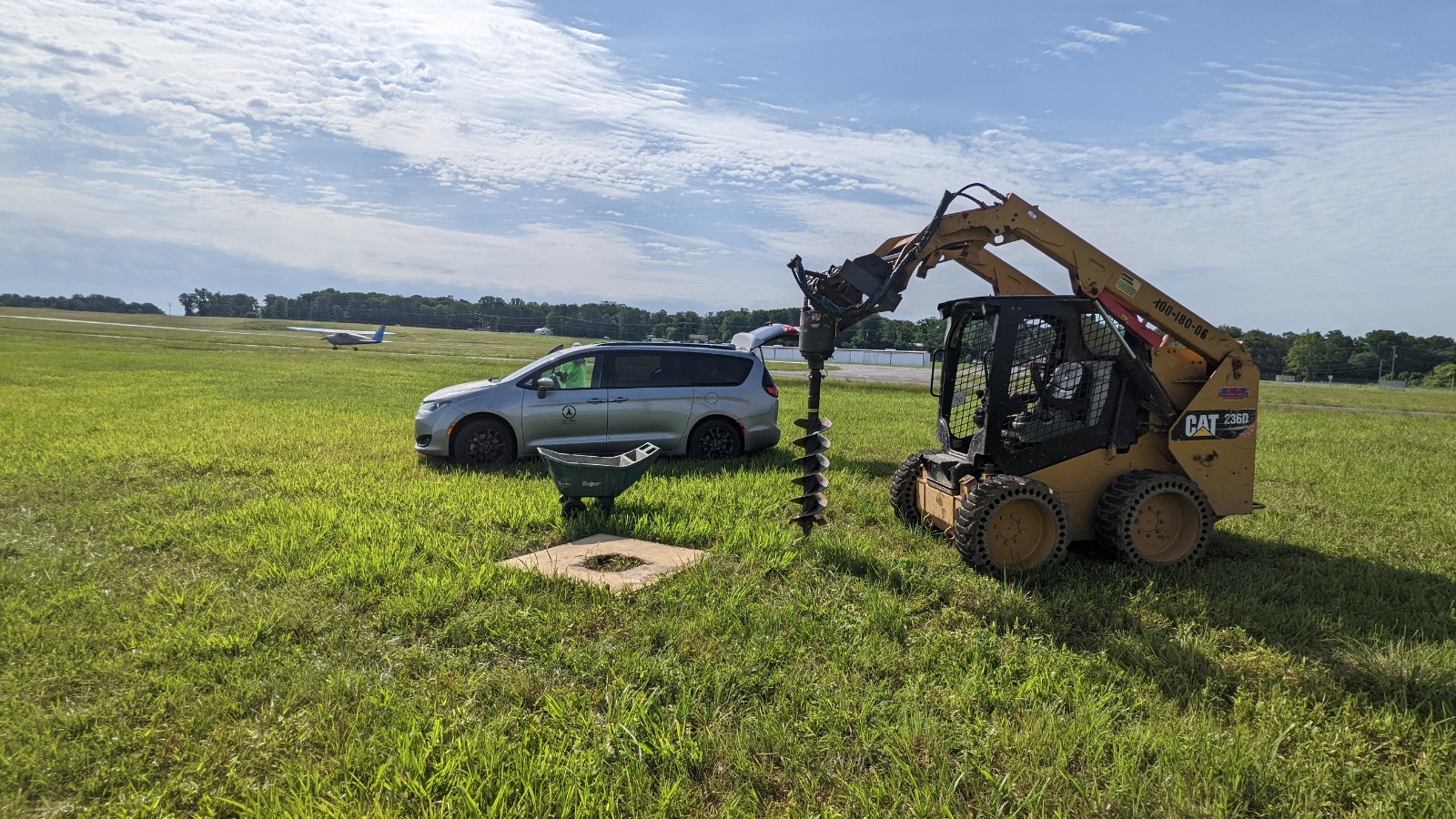
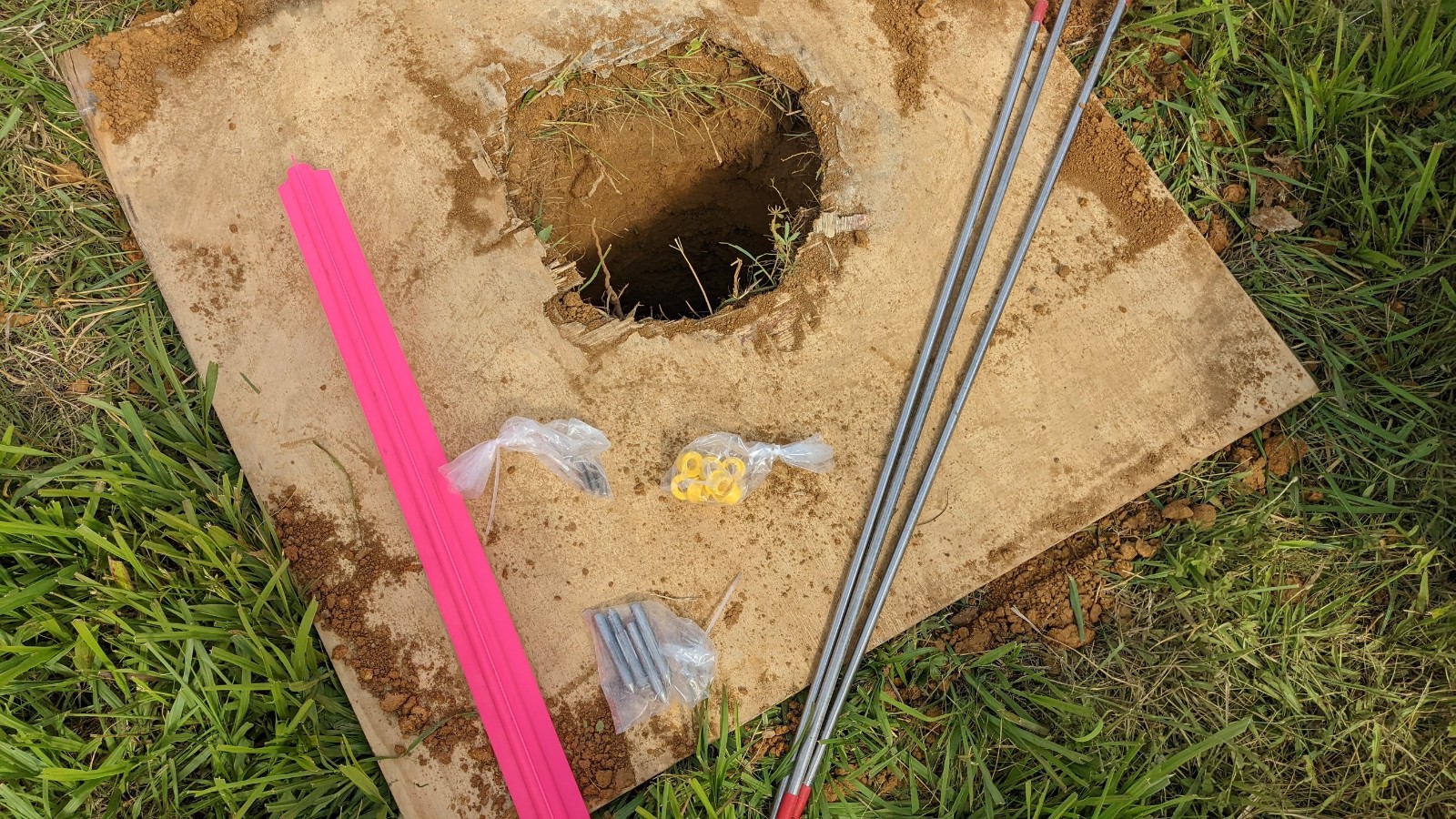
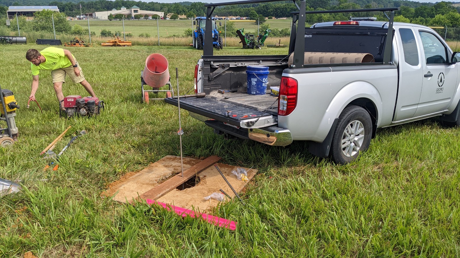
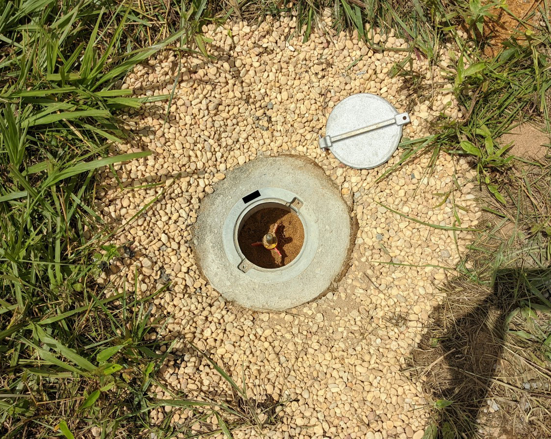
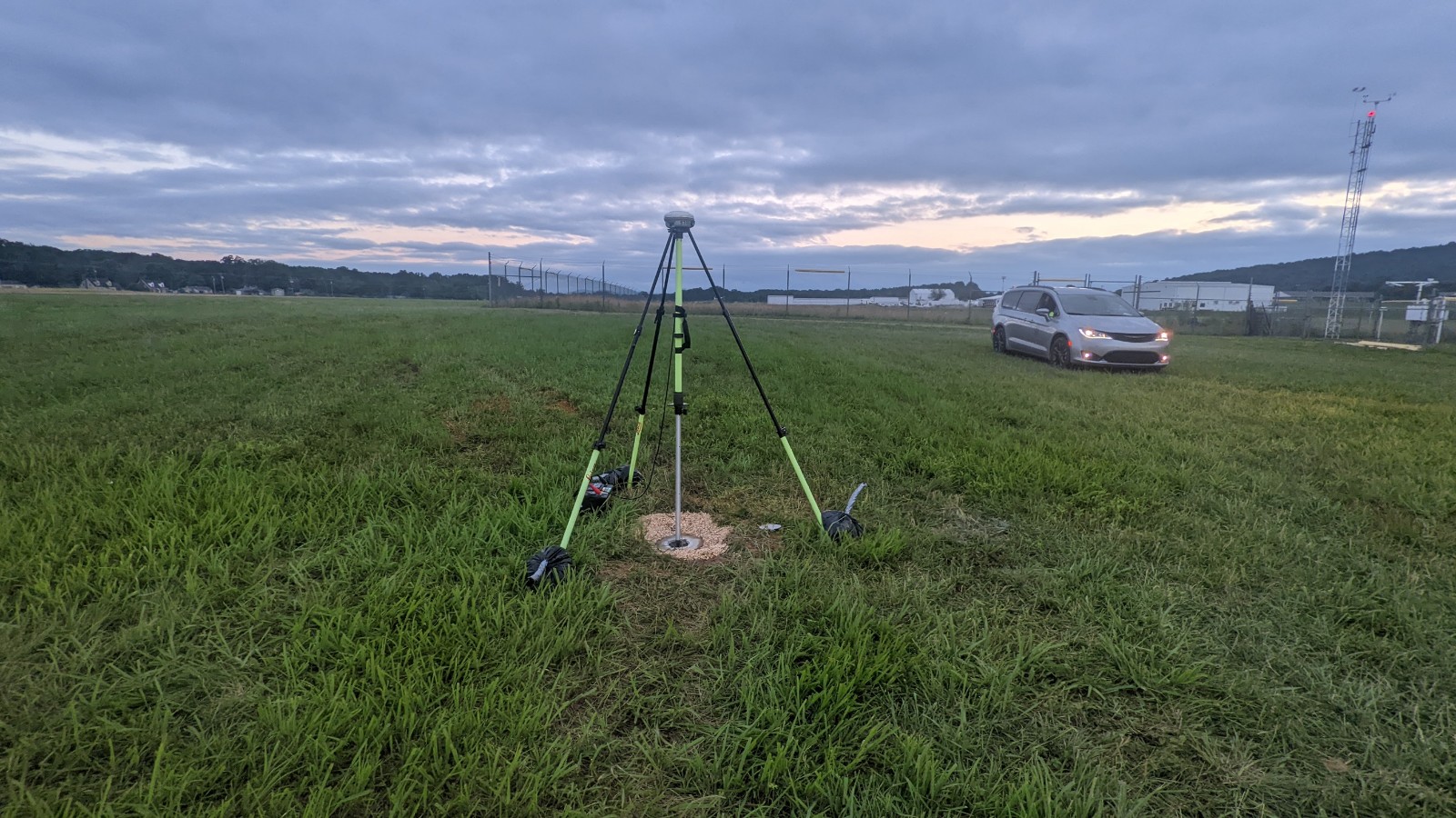
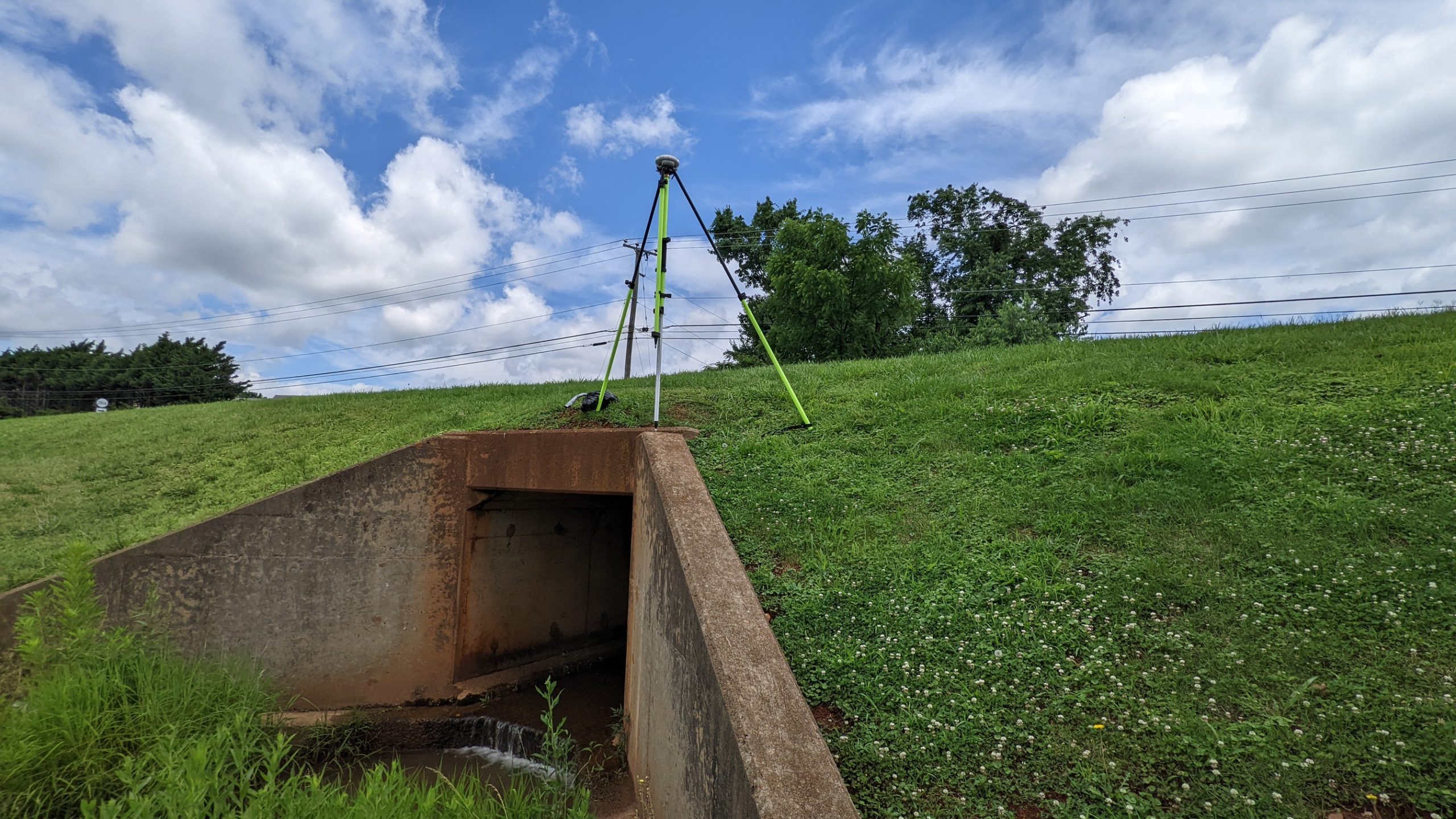
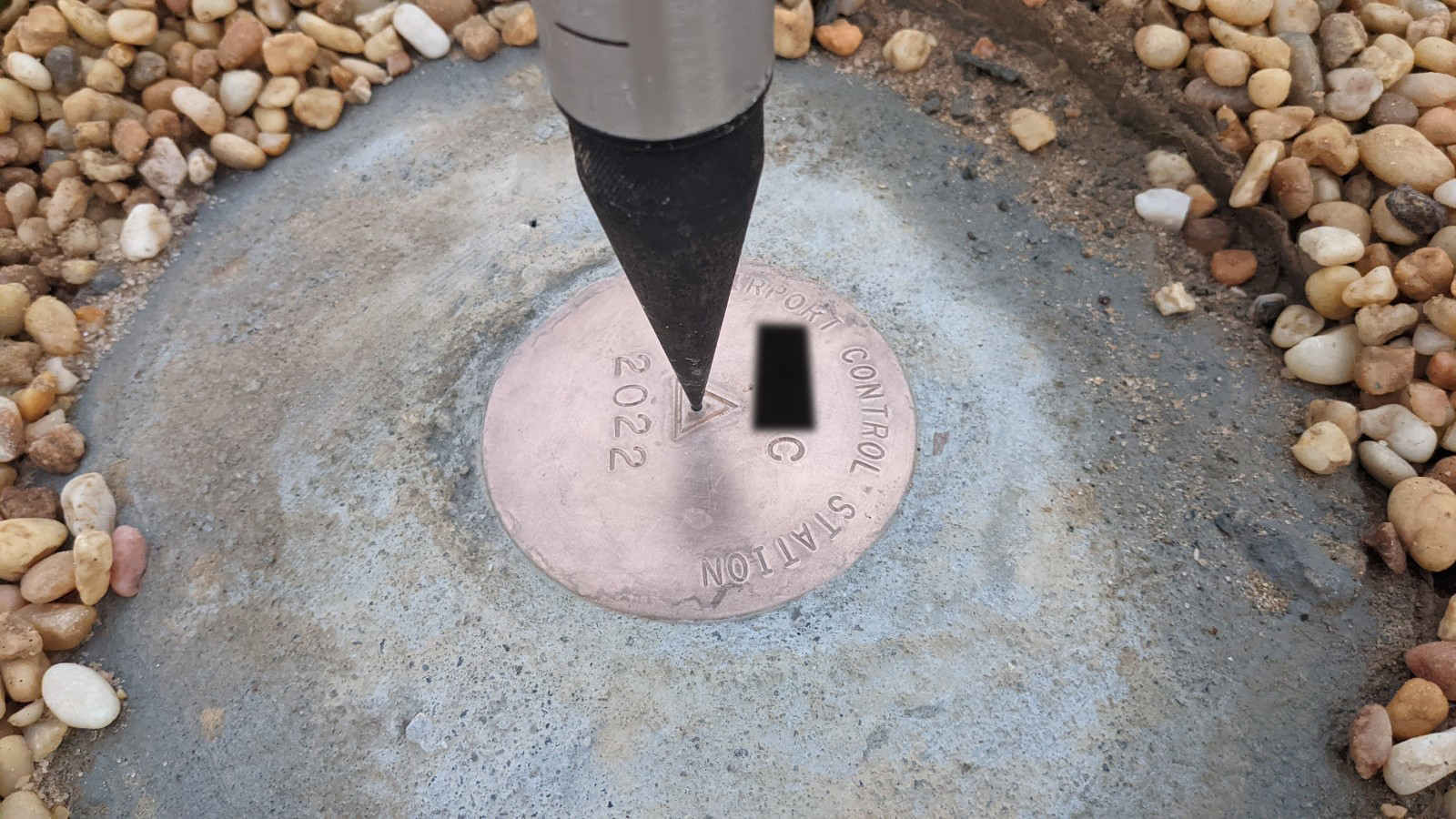
The workflow must be managed through the FAA Airport Data Information Portal (ADIP), Geopro handles all aspects of this for our clients. We then prepare necessary survey plans prior to any field survey work. A PACS & SACS project typically requires setting one “deep rod” and two concrete survey monuments at an airport. Depending on soil conditions, a skid steer with auger can be well worth the rental cost.Materials for a deep rod construction.For the PACS, a stainless steel rod is driven to refusal using a jackhammer, often at depths of 30 feet or more.The completed “deep rod” PACS mark with dimpled rod and protective logo lid. We finish the our monuments with pea-gravel around the edges to prevent grass growth. The stations are also recessed a few inches below the ground, to make the mowing crew’s lives easier.After construction is complete, Geopro begins many long hours of GPS observations with fixed-height tripods. Sand bags are used to stabilize. A typical PACS-SACS projects requires around 20 hours of GPS measurements.Simultaneous GPS observations of regional high-accuracy horizontal and vertical benchmarks are made to help establish the coordinates of the new monuments. A finished SACS monuments. Names have been obscured to protect the innocent.
After the monuments have been set and surveyed, there is an extensive reporting and data processing workflow that is commonly called “BlueBooking.” The specialized software that is required to complete this process is still DOS based and requires many years of training to do correctly. Geopro’s staff have been performing PACS/SACS establishment for over 20 years and still find these projects to be some of the most challenging to complete!