Airport GIS and Planimetric Mapping – Kenai, Alaska Completed in 2016, Geopro Consultants was the project lead on this AGIS mapping project conducted in support of Master Plan update at Kenai Municipal Airport (ENA). This Airport Layout Plan (ALP) project...
Obstruction Mapping at Eight Swedish Airports In 2017, Geopro was selected as part of an international team of airport geospatial experts to perform obstruction mapping and GIS data collection at multiple airports throughout Sweden. The data capture process began...
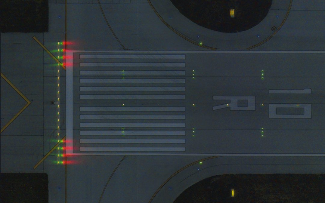
Night Mapping of Airfield Lights and Signs at Detroit Metro Airport In 2018, Geopro was asked to perform an inventory of airfield lights and signs at Detroit Metro Airport (DTW), the nineteenth busiest airport in the United States. The project presented unique...
Reagan National Airport (DCA): FAA Airport GIS Deliverable Development In 2015, Geopro Consultants was selected to provide FAA Airports GIS Deliverable Development Services for an obstacle mapping project Ronald Reagan Washington National Airport (DCA), in...
Completed in Summer 2014, Geopro collected aerial imagery and performed obstacle mapping in support of future tree clearing and construction at this bustling airport in western Pennsylvania.